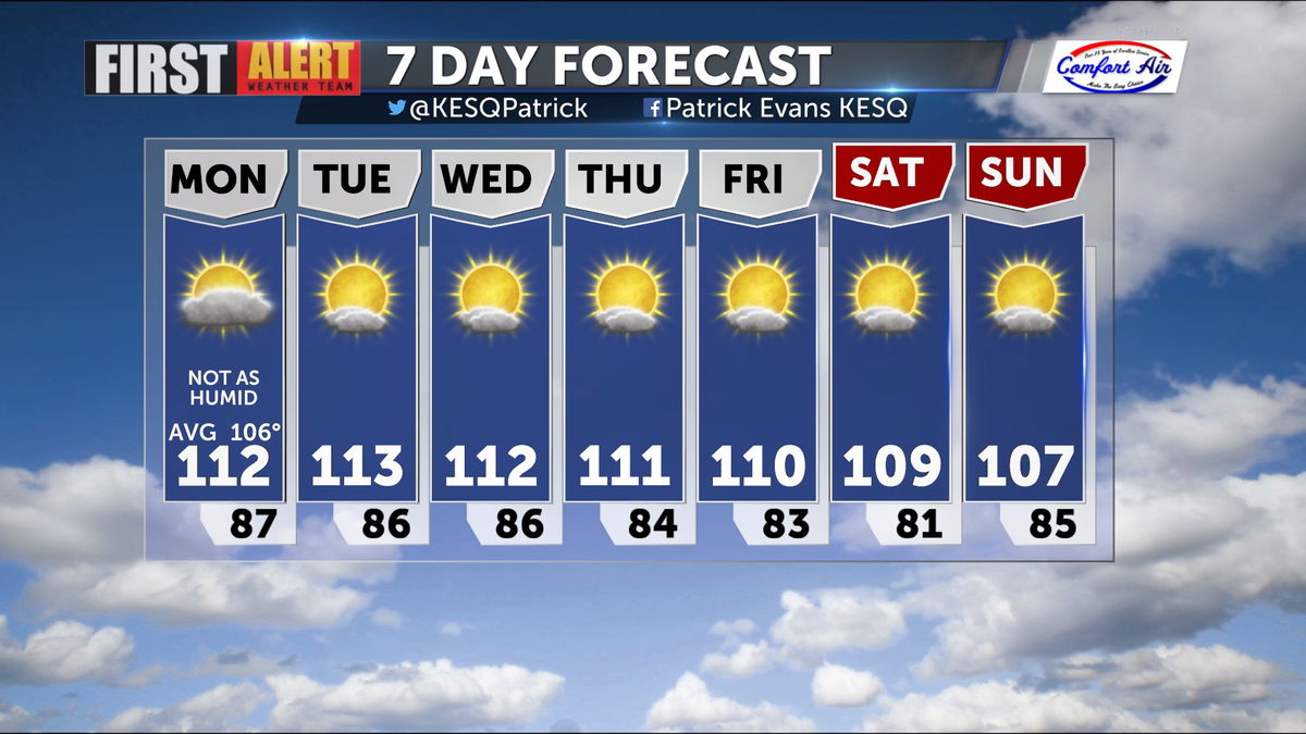
A Slow Return to Drier Weather
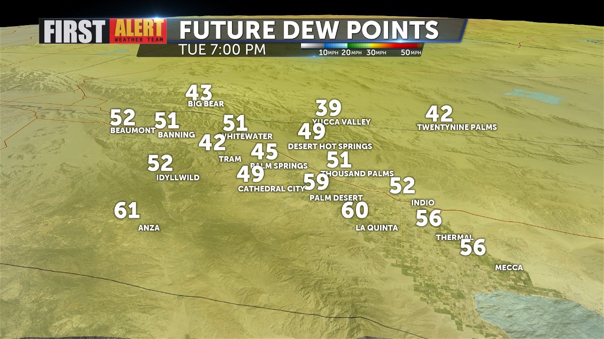
Dew points are still running in the 60s but we expect a gradual drying trend over the rest of the week.
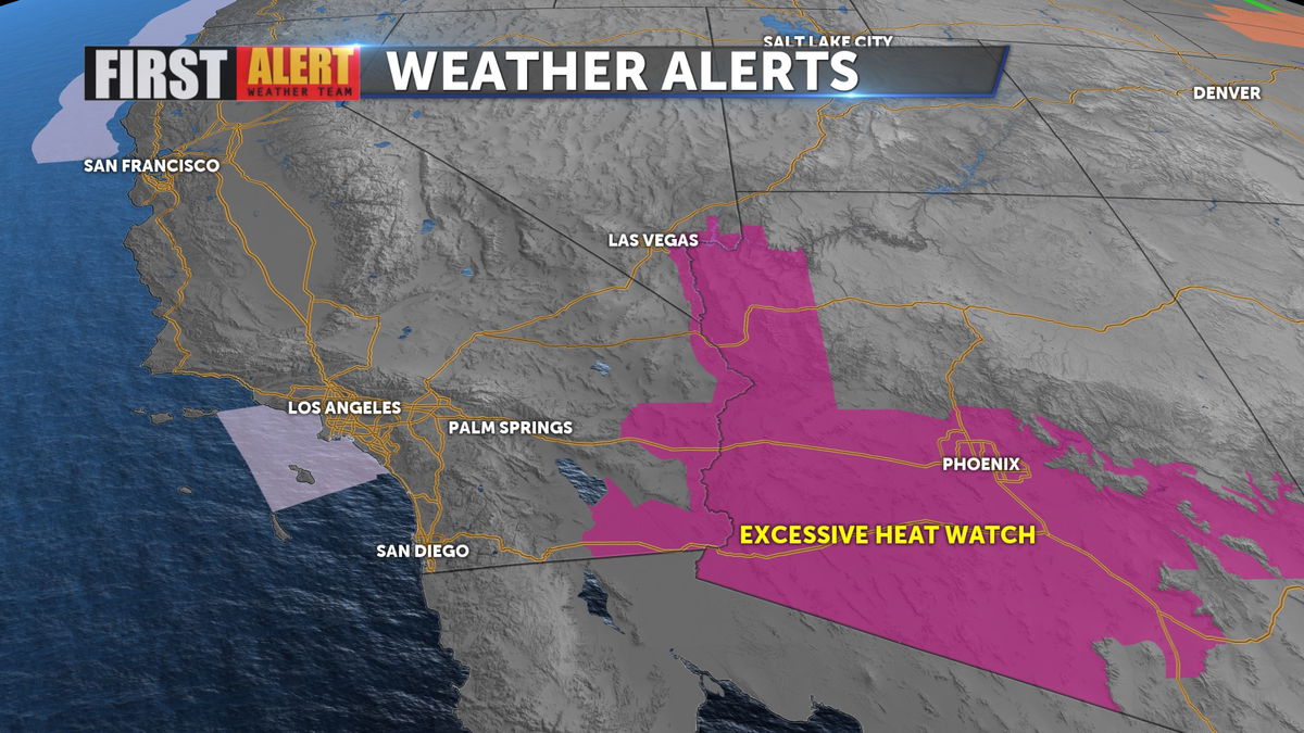
This should make things feel a bit better despite highs that still above average. While the Coachella Valley is not included, an Excessive Heat Watch is up for parts of the Desert Southwest through tomorrow evening.
With the hotter temps and elevated humidity today there is still a chance for scattered mountain storms later this afteroon.
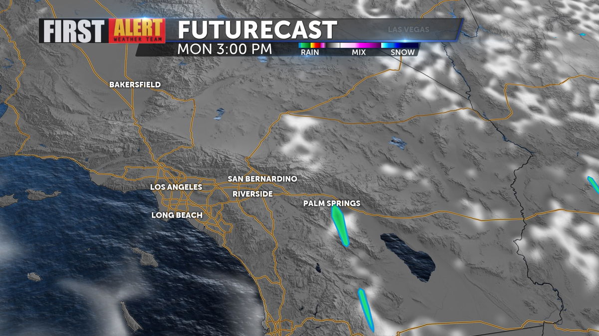
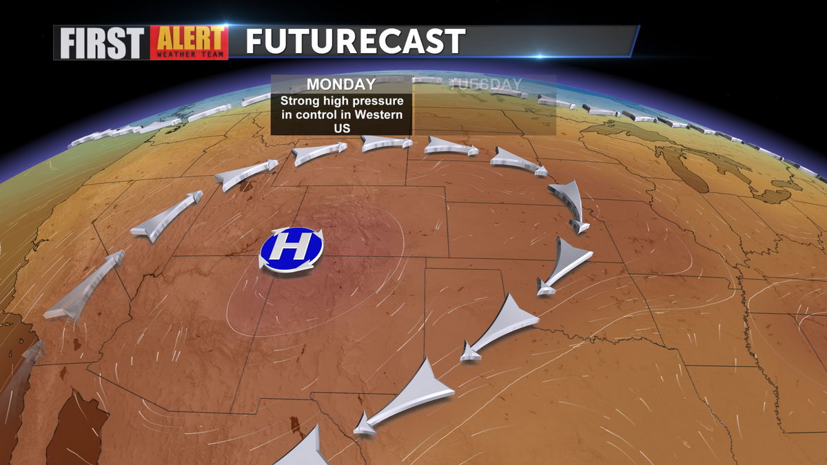
High pressure will dominate the weather pattern throughout the week, so highs will remain above normal, but the monsoonal moisture should continue to retreat.
We'll range between 110 and 113 just about all week long, with slightly cooler temps for the weekend.