Heat, Humidity, Thunderstorm Potential
The humidity continues to stream into the region as monsoon moisture flows in from the Southeast. Dew points will remain elevated through Wednesday.
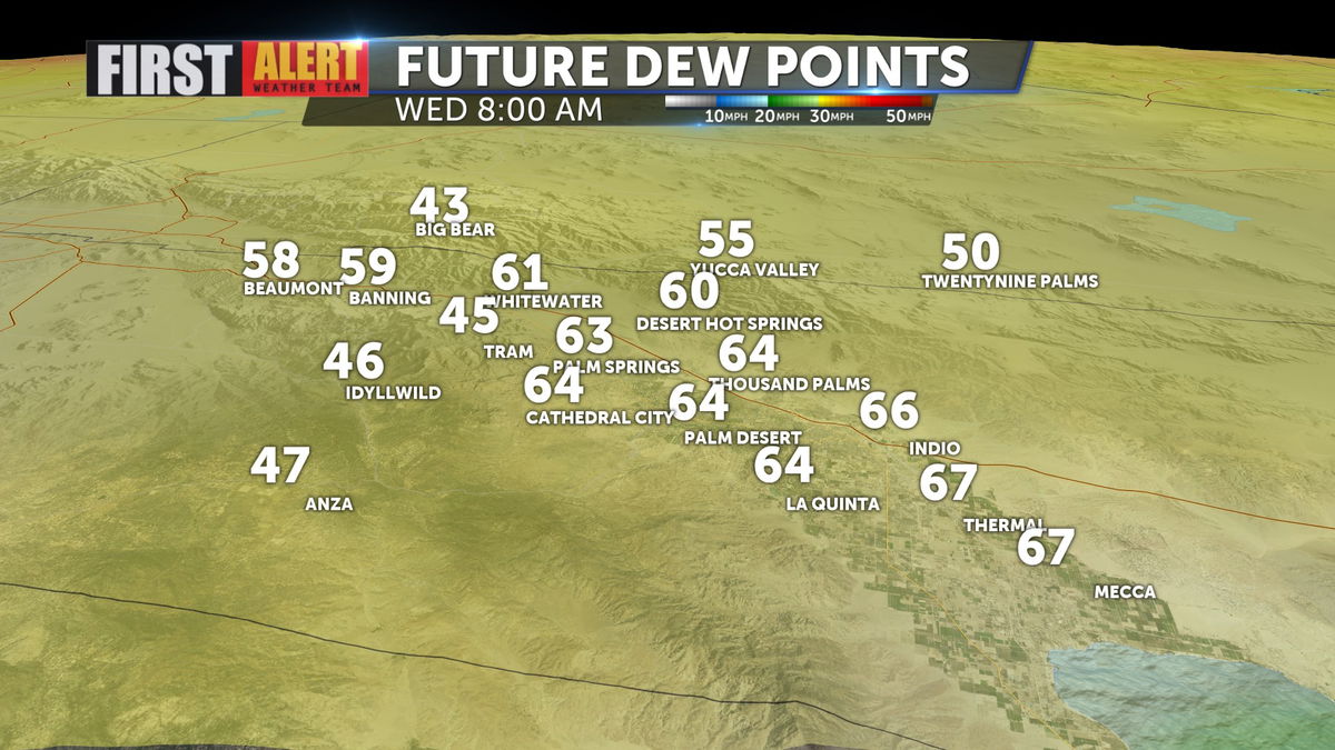
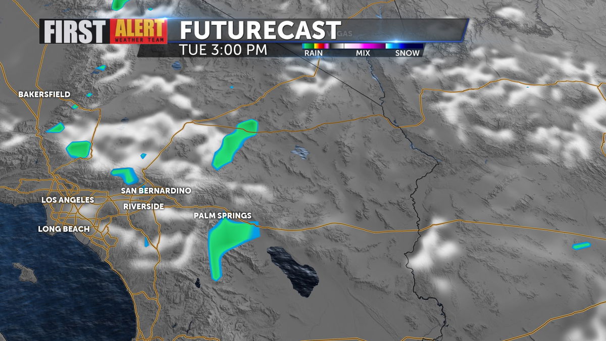
That elevated humidity will increase the chance of mountain and high desert storms, and also give rise to thunderstorms in the Inland Empire this afternoon.
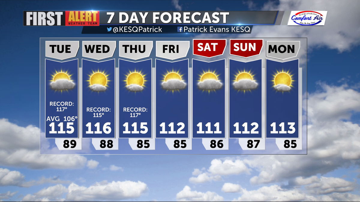
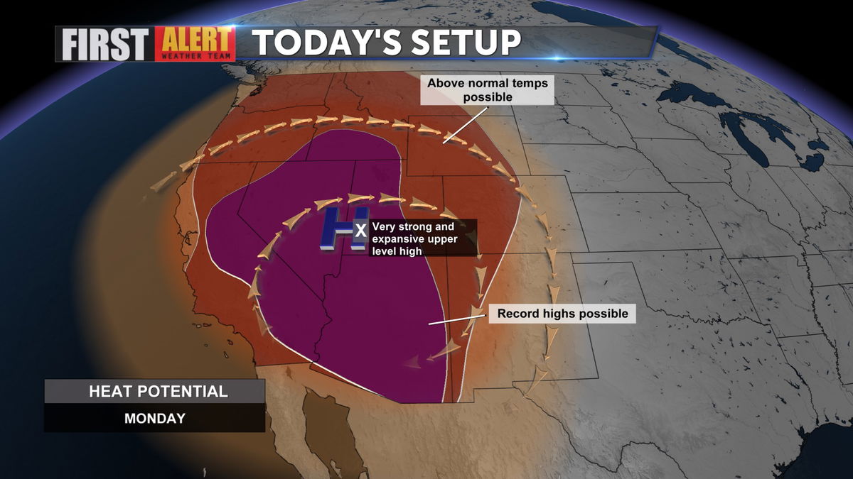
We remain under an Excessive Heat Warning through much of the rest of the week.
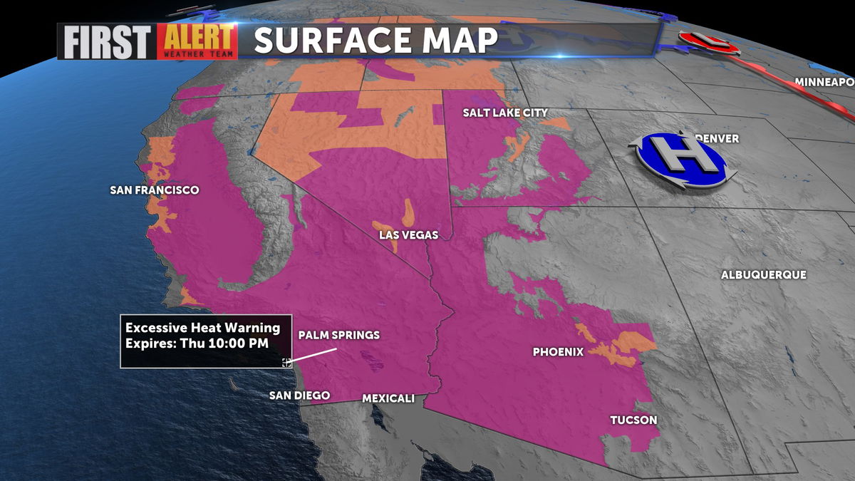
High pressure is the dominant feature on the map, keeping the heat up near record highs and pulling moisture into the region.
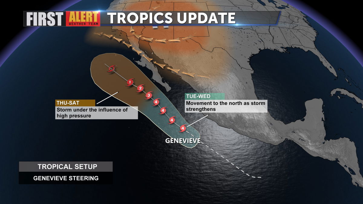
As the monsoon starts to ease late this week, Hurricane Genevieve, a powerful category 4 storm, will move North. The storm will run parallel to the Baja Coast causing wind and storms surge issues along with rain. The remnants of the storm may provide us with more humidity for the weekend.
Despite the fact that the Excessive Heat Warning expires Thursday, we see temps above 110 through the early part of next week.