Still Hot and Humid but Relief in Sight
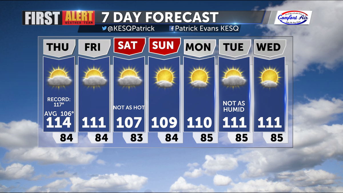
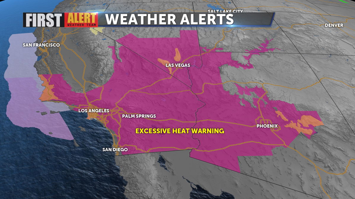
We remain under the Excessive Heat Warning until 10 PM, with some "cooler" highs expected into the weekend.
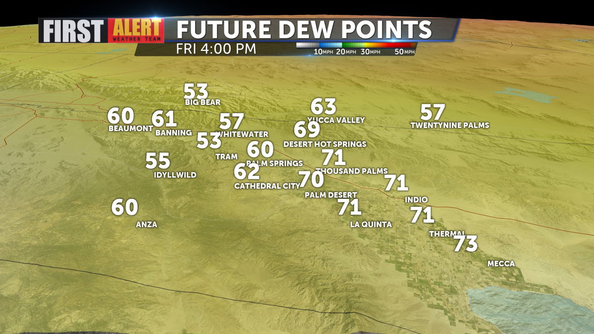
Dew points are still quite high, so it won't feel much better out there as highs move toward 114 today. Dew points will range in the 60s and 70s, prohibitive of evap cooler use.
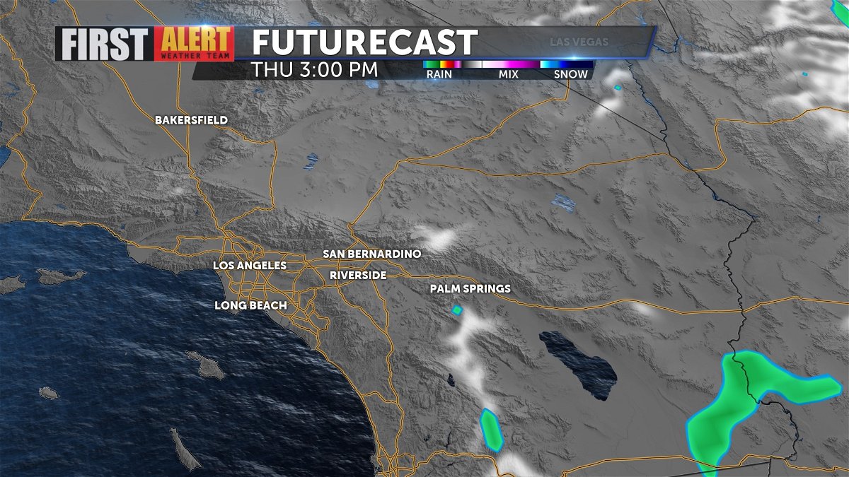
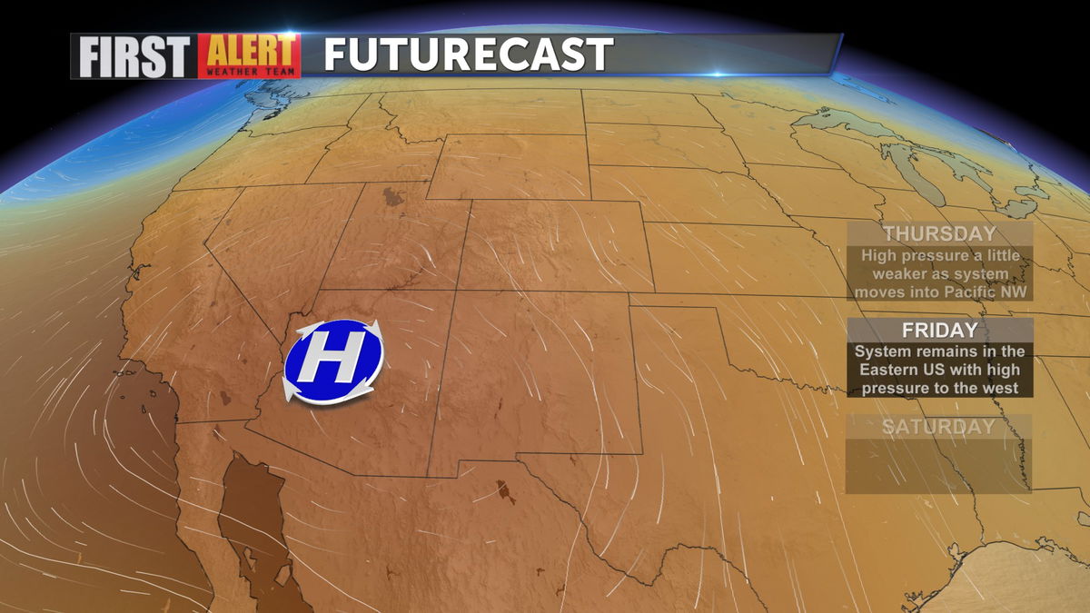
Despite those higher dew point levels, models showcase less in the way of storm development today, so expect calmer conditions in our local mountains and high desert communities.
High pressure remains intact and in place across the Desert Southwest through the weekend, so temps will stay above normal, just not as hot as the previous few days.
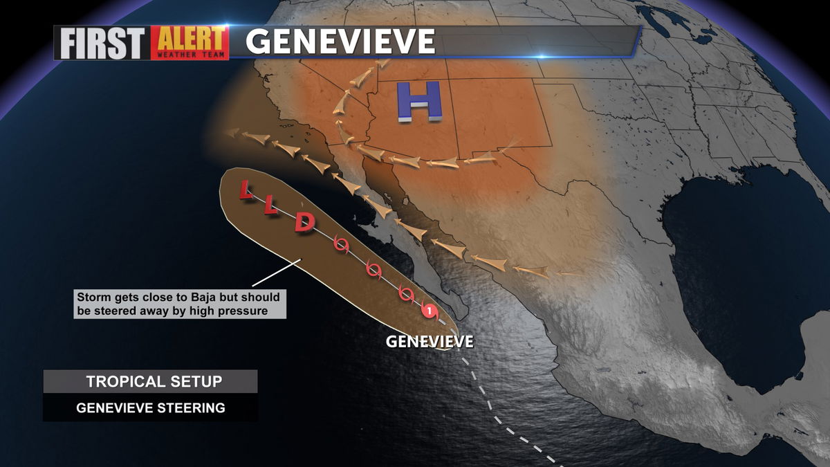
Humidity will be enhanced by the remnants of Hurricane Genevieve arriving in SoCal over the weekend, but by next week drier air should prevail.
Temperatures drop a bit into the weekend, actually falling below 110 degrees (briefly) and stabilize around 111 next week. The dew points will also drop a bit next week, so it will feel better outdoors.