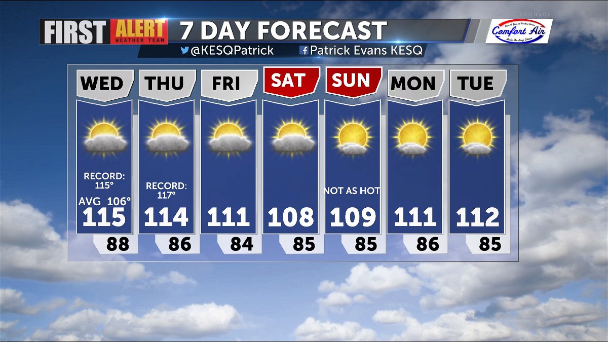
Record Highs Possible along with more Storm Potential
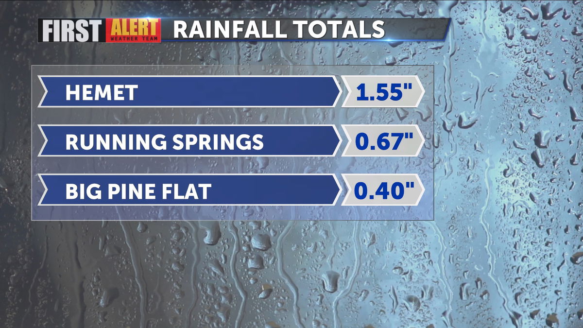
Yesterday severe storms ripped through areas of Riverside and San Bernardino counties, dropping heavy rain, hail and producing gusty winds with frequent lightning. Rainfall totals near Hemet beat 1.50" and caused a Flash Flood Warning.
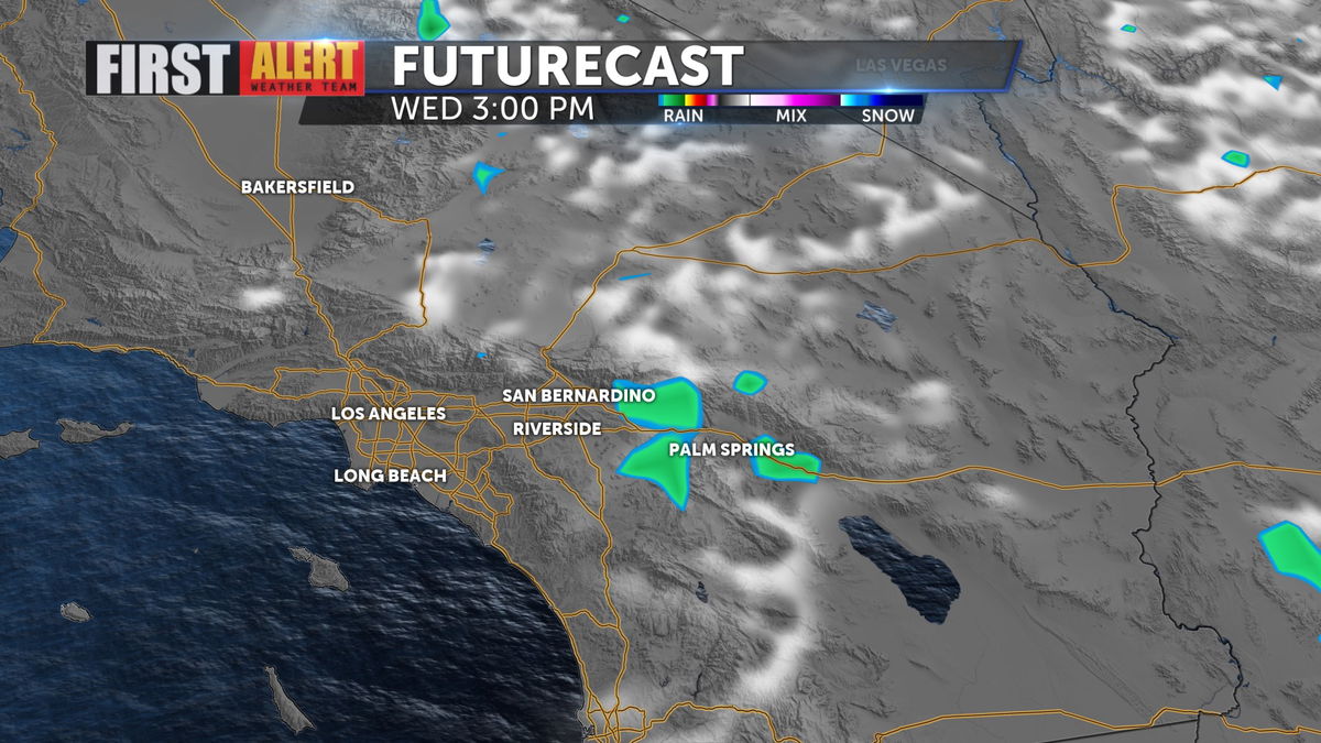
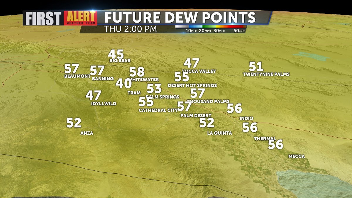
Today, dew points are equally high (and will remain high through tomorrow) giving rise to the possibility of more storms this afternoon.
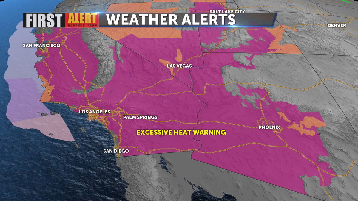
We also remain under an Excessive Heat Warning and if we top out at 115 as predicted, that will tie the record high for the date.
Dew points remain elevated through the weekend.
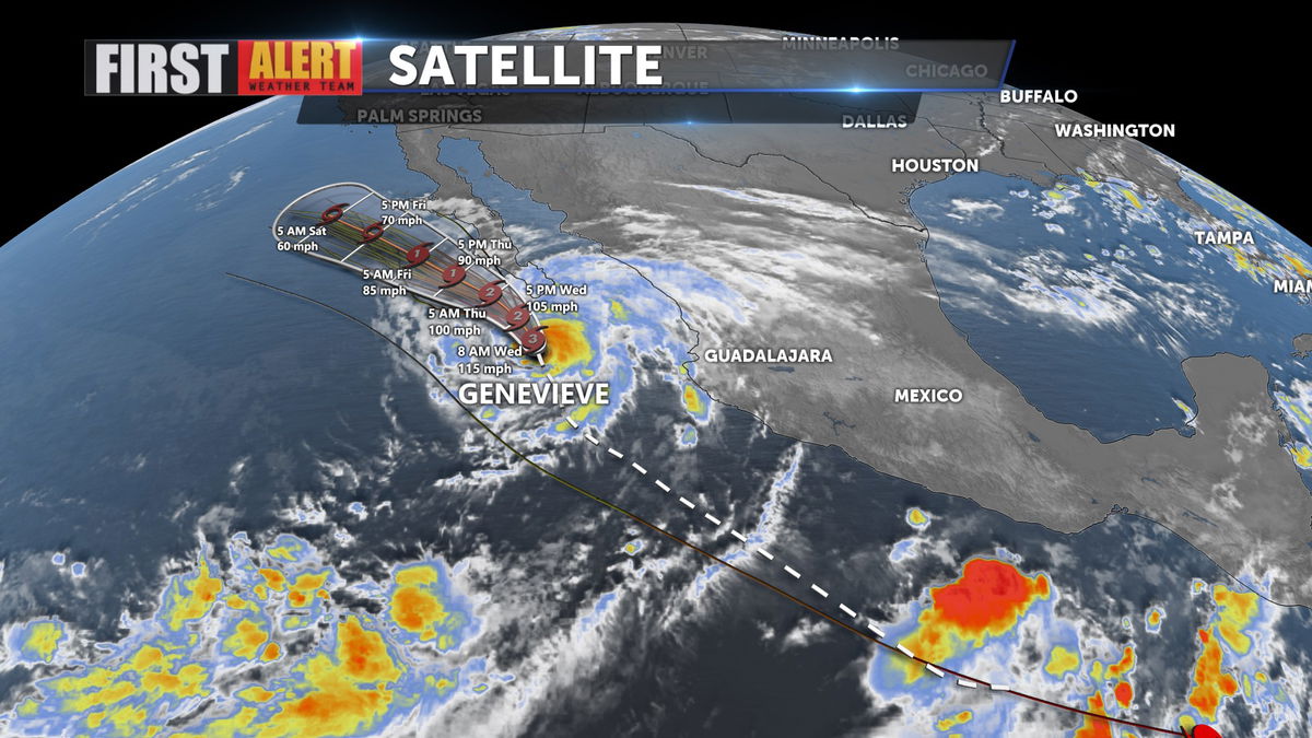
Over the weekend, those humidity levels may be enhanced by the remnants of Hurricane Genevieve, a powerful storm moving North just off the Baja Coast.
Highs do drop significantly over the next few days, finally topping out below 110 degrees over the weekend!